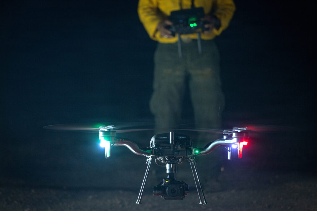
# Drones and AI Transform Wildfire Detection and Response
Unmanned aircraft have moved beyond experimental tools into operational firefighting during active burns across the western United States. The Sand Creek Fire in southwestern Montana, which ignited in early August and burned across steep terrain, deployed drones to locate smoldering hotspots in areas where ground crews faced hazards from unstable, fire-weakened trees. This shift represents a fundamental change in how land managers approach one of the nation's most destructive natural disasters.
Thermal imaging cameras mounted on commercial drones detect heat signatures invisible to the human eye. These aircraft can access ravines, ridgelines, and burned-over zones too dangerous for personnel on foot. A single drone flight lasting 20 to 30 minutes can survey terrain that would require a ground crew several hours to cover manually. In the Sand Creek Fire and similar incidents across Montana, Oregon, and California this season, drones have identified previously missed ember pockets that threatened to reignite after initial containment efforts.
The technology addresses a critical vulnerability in post-fire operations. After major fires burn through a landscape, residual heat persists for days or weeks. Firefighters patrolling burned areas face falling trees, unstable slopes, and ash-covered hazards. Drones eliminate personnel from these zones while accelerating detection timelines. Fire managers can deploy aircraft within hours of a fire's passage, rather than waiting for ground surveys to begin the next morning.
Artificial intelligence systems now analyze drone footage in real time or near-real time. Machine learning algorithms trained on thousands of wildfire images can classify heat signatures as genuine embers versus other heat sources like exposed rock or machinery. Some systems flag coordinates automatically and transmit them to ground crews via map applications. This automation compresses response times from hours to minutes.
Federal land management agencies, including the U.S. Forest Service and Bureau of Land Management, have expanded drone programs substantially since 2022. Operational guidelines now permit multiple concurrent drone flights during active incidents. Private contractors, including aerial surveying firms and specialized wildfire technology companies, have secured contracts with state and federal agencies to provide drone services during peak fire seasons.
Limitations persist. Wind speeds above 25 mph ground most commercial drones. Battery life typically restricts flights to under one hour per charge. Cloud cover and smoke can obscure thermal signatures. Dense forest canopy prevents drones from detecting ground-level heat in some situations. Coordination between drone operators, helicopter crews, and aircraft creates airspace management challenges that protocols continue to address.
Expansion into autonomous ground robotics remains nascent but accelerating. Prototype robotic systems designed to traverse burned terrain and deploy water or fire retardant on remaining hotspots have been tested in controlled settings. Fully autonomous decision-making in wildfire environments presents technical and liability questions that agencies are still working through.
The cumulative effect of drone deployment has already reduced the timeline for declaring fires fully contained. Incidents that previously required week-long monitoring for residual heat now achieve mop-up phases in days. As thermal imaging technology becomes cheaper and AI systems more reliable, adoption rates across smaller fire departments and state agencies will likely accelerate. The constraints are increasingly operational rather than technical.