# At the Grand Canyon, Flooding and Wildfire Underscore Compounding Extreme Weather Risks
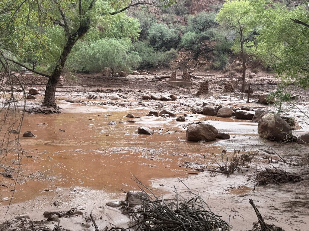
Flash flooding at Grand Canyon National Park killed at least two people this past weekend after an intense downpour dumped approximately one inch of rain in thirty minutes across portions of the Arizona landmark. The deluge transformed hiking trails and shallow creeks into dangerous rapids, trapping visitors and demonstrating how rapid precipitation events pose immediate threats in terrain designed by millennia of water carving.
The flooding followed scattered showers Saturday morning. The concentrated rainfall in the afternoon overwhelmed drainage systems across the park's vast landscape. Hikers and visitors found themselves caught in flash floods that developed with little warning. Search and rescue operations worked to locate missing persons and assist stranded visitors.
This flooding event arrives amid a broader pattern of climate-driven extreme weather compounding across the American West. The Grand Canyon region faces simultaneous pressures from intense precipitation events and the lingering effects of wildfires that alter landscape hydrology and erosion patterns. Burned vegetation cannot absorb water as effectively as intact forest and shrubland, making scorched terrain more vulnerable to flooding and debris flows when heavy rains arrive.
The Southwest has experienced a notable shift in precipitation patterns tied to warming temperatures and atmospheric circulation changes. Scientists have documented that the region's monsoon season, traditionally bringing July and August moisture, has become more erratic. When precipitation does occur, it often comes in shorter, more intense bursts rather than distributed rainfall. The National Interagency Fire Center data shows that wildfire seasons have lengthened and burned acreage has increased across the West since the 1980s, creating landscapes primed for hydrological extremes.
The Grand Canyon's geology makes it particularly vulnerable to flash flood hazards. The park's narrow canyons and steep terrain accelerate water flow. Hikers in slot canyons face especially acute risks, as water funnels through confined spaces with limited escape routes. The combination of recent wildfires in surrounding areas and increasingly intense precipitation events creates a dual hazard environment that park managers and visitors must navigate.
Grand Canyon National Park management has issued revised flash flood guidance and increased monitoring of drainage patterns, particularly in areas affected by recent fire activity. The National Weather Service expanded its flash flood watch protocols for the region, recognizing that fire-scarred watersheds require lower precipitation thresholds to trigger dangerous flood warnings.
This compounding extreme weather pattern reflects broader climate impacts across Western landscapes. The U.S. Geological Survey and academic institutions have documented how fire-driven ecosystem changes interact with precipitation variability to produce unexpected hydrological responses. A landscape that burns intensely in summer may transition to flood-prone conditions in monsoon season months later.
Climate projections from the Southwest Climate Adaptation Science Center indicate that extreme precipitation events will become more frequent across the region even as long-term average precipitation trends remain uncertain. Simultaneously, wildfire season duration is projected to extend into October and November in coming decades.
Parks, land management agencies, and visitor safety protocols face mounting pressure to adapt infrastructure and warning systems to this new reality of simultaneous and sequential extreme weather hazards. The Grand Canyon flooding illustrates how climate change does not simply intensify isolated weather phenomena but rather creates cascading risk interactions that exceed historical precedent.